logo

EbookBell.com

Most ebook files are in PDF format, so you can easily read them using various software such as Foxit Reader or directly on the Google Chrome browser.
Some ebook files are released by publishers in other formats such as .awz, .mobi, .epub, .fb2, etc. You may need to install specific software to read these formats on mobile/PC, such as Calibre.

Please read the tutorial at this link:  https://ebookbell.com/faq 


We offer FREE conversion to the popular formats you request; however, this may take some time. Therefore, right after payment, please email us, and we will try to provide the service as quickly as possible.


For some exceptional file formats or broken links (if any), please refrain from opening any disputes. Instead, email us first, and we will try to assist within a maximum of 6 hours.

EbookBell Team
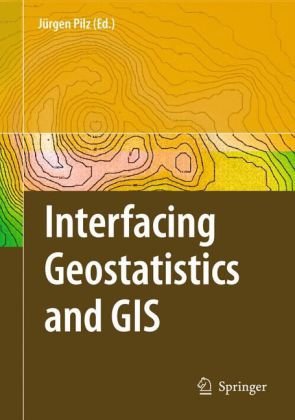
Interfacing Geostatistics and GIS 1st Edition by Jurgen Pilz ISBN 3540332359 9783540332350

  • SKU: BELL-2180618
Interfacing Geostatistics and GIS 1st Edition by Jurgen Pilz ISBN 3540332359 9783540332350
$ 31.00 $ 45.00 (-31%)

5.0

20 reviews

Interfacing Geostatistics and GIS 1st Edition by Jurgen Pilz ISBN 3540332359 9783540332350 instant download after payment.

Publisher: Springer-Verlag Berlin Heidelberg
File Extension: PDF
File size: 32.06 MB
Pages: 282
Author: Edzer J. Pebesma (auth.), Jürgen Pilz (eds.)
ISBN: 9783540332350, 9783540332367, 3540332359, 3540332367
Language: English
Year: 2009
Edition: 1

Product desciption

Interfacing Geostatistics and GIS 1st Edition by Jurgen Pilz ISBN 3540332359 9783540332350 by Edzer J. Pebesma (auth.), Jürgen Pilz (eds.) 9783540332350, 9783540332367, 3540332359, 3540332367 instant download after payment.

Interfacing Geostatistics and GIS 1st Edition by Jurgen Pilz - Ebook PDF Instant Download/Delivery: 3540332359, 9783540332350
Full download Interfacing Geostatistics and GIS 1st Edition after payment

Product details:

ISBN 10: 3540332359 
ISBN 13: 9783540332350
Author:  Jurgen Pilz

Most of the papers contained in this volume grew out of presentations given attheInternational Workshop StatGIS03 InterfacingGeostatistics, GISand Spatial Data Bases, which was held in Pörtschach, Austria, Sept. 29 Oct. 1, 2003, and ensuing discussions, afterwards. Some of the papers are new and have not been given at the conference. Therefore, most of the papers should not be considered as conference proceedings in its original sense but rather moreasself-containedandactualcontributionstothethemeoftheconference, the interfacing between geostatistics, geoinformation systems and spatial data base management. Although some progress has been made toward interfacing, we still feel thatthereisonlylittleoverlapbetweenthedi?erentcommunities.Thepresent volume is intended to provide a bridge between specialists working in di?erent areas. According to the topics of the above mentioned workshop, this volume has been divided into three parts: Part I starts with general aspects of geostatistical model building (Pebesma) and then new methodological developments in geostatics are p- sented, in particular this pertains to neural networks (Parkin and Kanevski), Gibbs ?elds as used in statistical physics (Hristopulos). Furthermore, new - velopments in Bayesian spatial interpolation with skewed heavy-tailed data and new classi?cation methods based on wavelets (Hofer et al.) and support vector machines (Chaouch et al.) are presented.

Interfacing Geostatistics and GIS 1st Table of contents:

Part I: Geostatistical Modeling Aspects and New (Geo)statistical Tools

  • This section focuses on theoretical and methodological advancements in geostatistics, including new modeling approaches and statistical tools.
    • How We Build Geostatistical Models and Deal with Their Output (by Edzer J. Pebesma)
    • Spartan Random Fields: Smoothness Properties of Gaussian Densities and Definition of Certain Non-Gaussian Models (by Dionissios T. Hristopulos)
    • Bayesian Trans-Gaussian Kriging with Log-Log Transformed Skew Data (by Gunter Spöck, Hannes Kazianka, and Jürgen Pilz)
    • Kriging and Splines: Theoretical Approach to Linking Spatial Prediction Methods
    • ANNEX Model: Artificial Neural Networks with External Drift Environmental Data Mapping
    • Regional Classification of Indoor Radon Data with Support Vector Machines and Geostatistical Tools
    • Daubechies Wavelets for Identification of Rock Variants from IR Spectra

Part II: Geostatistical Applications

  • This part showcases diverse applications of geostatistics across various fields.
    • Simulating the Effects of Rural Development Policies on Land Use: Evidence from Spatially Explicit Modeling in the Central Highlands of Vietnam (by Daniel Müller and Darla K. Munroe)
    • Kriged Road-Traffic Maps (by Hans Braxmeier, Volker Schmidt, and Evgeny Spodarev)
    • On Evaluation of Precipitation Fields with Rain Station Data (by Bodo Ahrens)
    • Robust Spatial Correlation Analysis of the ETEX-1 Tracer Data
    • Fuzzy Model of Soil Polygons for Managing the Imprecision
    • Mapping the Contaminant Legacy of a Coking Plant, The Avenue, Chesterfield, UK
    • A Note on Numerical Solutions of Least Squares Adjustment in GNU Project Gama
    • Presentation of Entrepreneurship Data and Aspects of Spatial Modeling

Part III: Integrated Information Systems: Combining (Geo)Statistics, GIS and RDBMS

  • This section addresses the challenges and successes of integrating geostatistics with GIS and relational database management systems (RDBMS).
    • Integrated Information Systems: Combining (Geo)Statistics, GIS and RDBMS
    • GIS, Users, Developers, and Spatial Statistics: On Monarchs and Their Clothing (by Alexander Krivoruchko and Roger S. Bivand)
    • Reassignment of the Farm Structure Statistical Data Using GIS and Spatialisation of the Results Based on Remotely Sensed Data
    • Epidemiological Information Systems
    • Geomatics, Epidemiology and BioStatistics: An Application to Acute Coronary Syndrome
    • Interactive Cumulative Curves for Exploratory Classification Maps
    • Combining REmbeddedPostgres and PostGIS

People also search for Interfacing Geostatistics and GIS 1st:

    
interfacing geostatistics and gis
    
what is data integration in gis
    
what is spatial interpolation in gis
    
uses of data layering in gis
    
what is spatial reference in gis


Tags: Jurgen Pilz, Interfacing, Geostatistics

Related Products