Most ebook files are in PDF format, so you can easily read them using various software such as Foxit Reader or directly on the Google Chrome browser.
Some ebook files are released by publishers in other formats such as .awz, .mobi, .epub, .fb2, etc. You may need to install specific software to read these formats on mobile/PC, such as Calibre.
Please read the tutorial at this link: https://ebookbell.com/faq
We offer FREE conversion to the popular formats you request; however, this may take some time. Therefore, right after payment, please email us, and we will try to provide the service as quickly as possible.
For some exceptional file formats or broken links (if any), please refrain from opening any disputes. Instead, email us first, and we will try to assist within a maximum of 6 hours.
EbookBell Team
5.0
30 reviews
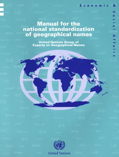
ISBN 10: 9211614902
ISBN 13: 978-9211614909
Author: United Nations
The present publication is designed primarily to assist countries that do not have an appropriate authority and a specific set of standards for the consistent rendering of their geographical names. The information in the Manual consists of suggestions that should be useful to those intersted in ways to standardize their nations geographical names
Part one. Organization of a national programme for geographical names standardization
I. Definitions and standardization
II. Names and language
III. Programme requirements
IV. Types of national geographical names authorities
V. Beginning a programme
VI. Standardization procedures
VII. Office treatment of geographical names
VIII. Researching name problems
IX. Field collection of names
X. Dissemination of official toponyms
Part two. Some selected readings on geographical names standardization
I. Role of the United Nations in the standardization of geographical names: some fifty years on
II. Language and the conversion of geographical names
III. Some examples of legislation concerning geographical names authorities
IV. Office processing—storing the data and maintaining the records: some basic thoughts on data fields
V. The social and cultural values of geographical names
VI. Exonyms, also called conventional names
VII. From fieldwork to authorized names: the “owner decides” principle followed in the Netherlands
VIII. Example from the Netherlands of written instructions to surveyors for collecting toponyms in the field
IX. Toponymic guidelines for map and other editors, for international use (from the 1970s to the present)
X. Some selected websites relevant to geographical names standardization
Figures
I. First training course held by the United Nations Group of Experts on Geographical Names, hosted by Bakosurtanal (National Coordinating Agency for Surveys and Mapping) in Cisarua, Indonesia, 1982
II. Some examples of different scripts: Russian Cyrillic, Arabic and Chinese
III. Basic types of national geographical names authorities
IV. Decision-making on geographical names: a geographical names committee in session
V. Multiple names for a place or feature shown on a map by parenthesizing one of the names.
VI. Multilingual road sign for a community in the County of Finnmark, northern Norway: Lakselv (Norwegian); Leavdnja (Saami); Lemmijoki (Kvenish/Finnish)
VII. Working in a geographical names office
VIII. Example of a toponymic database (for Mozambique) developed to enter information from existing card records
IX. Example from New Zealand of a name submission form for use by the public in proposing names for unnamed features or changes to existing names
X. Steps involved in the field collection of geographical names, in many cases including the use of computers to facilitate the recording or processing of the names data
XI. Planning for local fieldwork.
XII. Discussion with village leaders prior to collection of local toponyms in Brunei Darussalam
XIII. Field collection of geographical names in progress: collaboration over provision of locally used names of nearby features (South Africa)
XIV. Recording of geographical names on a base map outline
XV. Example of a form used in Norway for the field collection of geographical names
XVI. Discussion and verification of the results of fieldwork
XVII. Example of gazetteer content and part of a page layout, as illustrated in the bilingual publication entitled Concise Gazetteer of Canada/Répertoire toponymique concis du Canada
XVIII. Number of delegates, countries, specialized agencies and intergovernmental and other organizations participating at United Nations Conferences on the Standardization of Geographical Names
XIX. Participation of countries at the United Nations Conferences on the Standard-ization of Geographical Names, by number of conferences attended
XX. Working groups of the United Nations Group of Experts on Geographical Names and the overall structure of United Nations Conferences on the Standardization of Geographical Names, the Group of Experts and the Divisions of the Group of Experts
XXI. Conceptual representation of geographical names knowledge
XXII. Red Square in Moscow
XXIII. Bilingual map presentation with Frisian minority names first and Dutch majority names in parentheses
manual for the national standardization
manual for the national standardization of geographical names
what is standardization pdf
what is standard and standardization
standards.manual
Tags: United Nations, Manual, National Standardization, Geographical Names