logo

EbookBell.com

Most ebook files are in PDF format, so you can easily read them using various software such as Foxit Reader or directly on the Google Chrome browser.
Some ebook files are released by publishers in other formats such as .awz, .mobi, .epub, .fb2, etc. You may need to install specific software to read these formats on mobile/PC, such as Calibre.

Please read the tutorial at this link:  https://ebookbell.com/faq 


We offer FREE conversion to the popular formats you request; however, this may take some time. Therefore, right after payment, please email us, and we will try to provide the service as quickly as possible.


For some exceptional file formats or broken links (if any), please refrain from opening any disputes. Instead, email us first, and we will try to assist within a maximum of 6 hours.

EbookBell Team
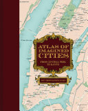
Atlas Of Imagined Cities From Central Perk To Kanto 1st Edition Matt Brown

  • SKU: BELL-53727758
Atlas Of Imagined Cities From Central Perk To Kanto 1st Edition Matt Brown
$ 31.00 $ 45.00 (-31%)

5.0

90 reviews

Atlas Of Imagined Cities From Central Perk To Kanto 1st Edition Matt Brown instant download after payment.

Publisher: Rizzoli Publications.
File Extension: EPUB
File size: 113.76 MB
Pages: 140
Author: Matt Brown, Rhys B. Davies.
ISBN: 9781849947787, 1849947783
Language: English
Year: 2023
Edition: 1
Volume: 1

Product desciption

Atlas Of Imagined Cities From Central Perk To Kanto 1st Edition Matt Brown by Matt Brown, Rhys B. Davies. 9781849947787, 1849947783 instant download after payment.

Explore the fictional topography of the most inspiring world cities—including London, New York, Los Angeles, Paris, and Tokyo—in this new book from the creators of the award-winning Atlas of Imagined Places. Did you know that James Bond and George Smiley were practically neighbors, or that girls-about-town Holly Golightly, Annie Hall, and Carrie Bradshaw all lived a couple of blocks from one another? Fourteen of the most stunning city maps show exactly where your characters lived, loved, worked, and played. Find out where to enjoy a coffee from Central Perk (Friends), a butterbeer in the Leaky Cauldron (Harry Potter), or a revolutionary tipple in the Defarge Wine Shop (A Tale of Two Cities). Navigate round London’s fictional tube network, from Walford East (EastEnders) to Hobbs End (Quatermass). Or fly between cities on one of a dozen fictional airlines (mapped to their home airports). Characters’ homes, bars, clubs, metro stations, and skyscrapers that you’ve seen or read about are all plotted in beautiful vintage-style city maps. The maps draw from the movies, TV, novels, video games, and more, all painstakingly tracked down, mapped, annotated, and wittily divulged by the authors. Let them show you how to get to Sesame Street, and thousands of other places, in this indispensable guidebook to all those places you always wanted to visit...if only they were real.

Related Products