logo

EbookBell.com

Most ebook files are in PDF format, so you can easily read them using various software such as Foxit Reader or directly on the Google Chrome browser.
Some ebook files are released by publishers in other formats such as .awz, .mobi, .epub, .fb2, etc. You may need to install specific software to read these formats on mobile/PC, such as Calibre.

Please read the tutorial at this link:  https://ebookbell.com/faq 


We offer FREE conversion to the popular formats you request; however, this may take some time. Therefore, right after payment, please email us, and we will try to provide the service as quickly as possible.


For some exceptional file formats or broken links (if any), please refrain from opening any disputes. Instead, email us first, and we will try to assist within a maximum of 6 hours.

EbookBell Team
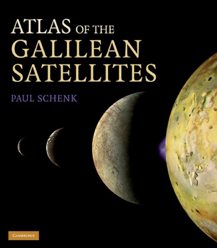
Atlas Of The Galilean Satellites Paul Schenk

  • SKU: BELL-2309584
Atlas Of The Galilean Satellites Paul Schenk
$ 31.00 $ 45.00 (-31%)

4.0

96 reviews

Atlas Of The Galilean Satellites Paul Schenk instant download after payment.

Publisher: Cambridge University Press
File Extension: PDF
File size: 36.87 MB
Pages: 404
Author: Paul Schenk
ISBN: 9780521868358, 0521868351
Language: English
Year: 2010

Product desciption

Atlas Of The Galilean Satellites Paul Schenk by Paul Schenk 9780521868358, 0521868351 instant download after payment.

Полные цветные глобальные карты и мозаики с высоким разрешением - Юпитера , Европы, Ганимеда и Каллисто - собраны впервые в этом атласе , изображения, взяты с недавней миссии Галилео, этот атлас - гид картографии для исследователей. Complete color global maps and high-resolution mosaics of Jupiters four large moons - Io, Europa, Ganymede and Callisto - are compiled for the first time in this important atlas. The satellites are revealed as four visually striking and geologically diverse planetary bodies: Ios volcanic lavas and plumes and towering mountains; Europas fissured ice surface; the craters, fractures and polar caps of Ganymede; and the giant impact basins, desiccated plains and icy pinnacles of Callisto. Featuring images taken from the recent Galileo mission, this atlas is a comprehensive mapping reference guide for researchers. It contains 65 global and regional maps, nearly 250 high-resolution mosaics, and images taken at resolutions from 500 meters to as high as 6 meters.

Related Products