logo

EbookBell.com

Most ebook files are in PDF format, so you can easily read them using various software such as Foxit Reader or directly on the Google Chrome browser.
Some ebook files are released by publishers in other formats such as .awz, .mobi, .epub, .fb2, etc. You may need to install specific software to read these formats on mobile/PC, such as Calibre.

Please read the tutorial at this link:  https://ebookbell.com/faq 


We offer FREE conversion to the popular formats you request; however, this may take some time. Therefore, right after payment, please email us, and we will try to provide the service as quickly as possible.


For some exceptional file formats or broken links (if any), please refrain from opening any disputes. Instead, email us first, and we will try to assist within a maximum of 6 hours.

EbookBell Team
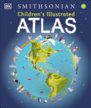
Childrens Illustrated Atlas David Green

  • SKU: BELL-49270470
Childrens Illustrated Atlas David Green
$ 31.00 $ 45.00 (-31%)

4.4

42 reviews

Childrens Illustrated Atlas David Green instant download after payment.

Publisher: DK Publishing
File Extension: EPUB
File size: 68.52 MB
Pages: 128
Author: David Green
ISBN: 9780744073881, 074407388X
Language: English
Year: 2016

Product desciption

Childrens Illustrated Atlas David Green by David Green 9780744073881, 074407388X instant download after payment.

A picture atlas that takes young readers on a visual journey around the world, from Spain and Portugal to China and Mongolia. Continents and countries are brought to life through stunning photography and eye-catching illustrations. Uncover incredible geographical features, wildlife, culture, history, and landmarks in unprecedented detail. This incredible and inspiring visual atlas takes you on a fact-filled, continent-by-continent tour of the world. Throughout the pages of this adventure book, you’ll discover more than 50 fascinating maps packed with fun facts and fresh images. Your child will learn all about the climate, populations, places, and industries of our world. Picture stories complement the maps, from the giant Amazon River flowing through the rainforest to the frozen icebergs of the glacial Arctic. Discover the richness and diversity of human and animal life around the globe. Each map shows countries with their capitals, famous landmarks, longest rivers, and highest mountains. This educational book is more than an atlas! It also shows young explorers how to read a map and use a key, compass, and scale. It’s the ideal resource for classroom use, home learning, and armchair exploration. The Ultimate Round-The-World Trip. Children's Illustrated Atlas is the perfect reference book for kids to learn about lands close to home or oceans far away! It’s also a fantastic gift for children with an interest in the world around them and a taste for adventure. Without even leaving your home, this children’s atlas book allows you to: • Explore more than 50 stunning world maps and incredible geographical features. • Learn how to read a map and use a key, compass, and scale. • Travel the world's cities and landmarks through beautiful photography and illustrations. • Dive into intriguing facts about the world's population. Complete the Series: Charming and informative, the Children's Illustrated Atlas series from DK Books is a delightful addition to every child's library. Bring the amazing world of wildlife right into your home with the Children's Illustrated Animal Atlas and reach into the past with the Children's Illustrated History Atlas.

Related Products