Most ebook files are in PDF format, so you can easily read them using various software such as Foxit Reader or directly on the Google Chrome browser.
Some ebook files are released by publishers in other formats such as .awz, .mobi, .epub, .fb2, etc. You may need to install specific software to read these formats on mobile/PC, such as Calibre.
Please read the tutorial at this link: https://ebookbell.com/faq
We offer FREE conversion to the popular formats you request; however, this may take some time. Therefore, right after payment, please email us, and we will try to provide the service as quickly as possible.
For some exceptional file formats or broken links (if any), please refrain from opening any disputes. Instead, email us first, and we will try to assist within a maximum of 6 hours.
EbookBell Team
4.4
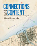
52 reviewsBehind every great map is a network and behind every great network is a map.
In Connections and Content: Reflections on Networks and the History of Cartography, cartographic cogitator Mark Monmonier shares his insights about the relationships between networks and maps through a collection of essays. Using historical maps, he explores
Triangulation networks used to establish the baselines of a map’s scale,
Astronomical observations, ellipsoids, geodetic arcs, telegraph networks, and GPS constellations that establish latitude and longitude at control stations,
Cartographic symbols that portray network features on a map,
Survey networks used to situate and construct canals, railways, roads, and power lines,
Postal and electronic networks that created and disseminated weather maps, and
Topological networks that underlie modern census enumeration and satellite navigation systems.
Connecting the past to the present via maps and reflection, Monmonier continues his contribution to cartographic scholarship by demonstrating the network as a unifying concept for understanding and using maps.