logo

EbookBell.com

Most ebook files are in PDF format, so you can easily read them using various software such as Foxit Reader or directly on the Google Chrome browser.
Some ebook files are released by publishers in other formats such as .awz, .mobi, .epub, .fb2, etc. You may need to install specific software to read these formats on mobile/PC, such as Calibre.

Please read the tutorial at this link:  https://ebookbell.com/faq 


We offer FREE conversion to the popular formats you request; however, this may take some time. Therefore, right after payment, please email us, and we will try to provide the service as quickly as possible.


For some exceptional file formats or broken links (if any), please refrain from opening any disputes. Instead, email us first, and we will try to assist within a maximum of 6 hours.

EbookBell Team
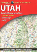
Delorme Atlas Gazetteer Utah 11th Ed Delorme

  • SKU: BELL-38373226
Delorme Atlas Gazetteer Utah 11th Ed Delorme
$ 31.00 $ 45.00 (-31%)

4.3

18 reviews

Delorme Atlas Gazetteer Utah 11th Ed Delorme instant download after payment.

Publisher: DELORME PUBLISHING
File Extension: PDF
File size: 132.18 MB
Pages: 64
Author: Delorme
ISBN: 9781946494283, 1946494283
Language: English
Year: 2019
Edition: 11th ed.

Product desciption

Delorme Atlas Gazetteer Utah 11th Ed Delorme by Delorme 9781946494283, 1946494283 instant download after payment.

With an incredible wealth of detail, DeLorme's Atlas & Gazetteer is the perfect companion for exploring the Utah outdoors. Extensively indexed, full-color topographic maps provide information on everything from cities and towns to historic sties, scenic drives, trailheads, boat ramps, and even prime fishing spots. Conveniently bound in book form, the Atlas & Gazetteer is your most comprehensive guide to Utah's backcountry. Product Details: Full-color topographic maps provide information on everything from cities and towns to historic sites, scenic drives, recreation areas, trailheads, boat ramps, and prime fishing spots Extensively indexed Handy latitude/longitude overlay grid for each map allows you to navigate with GPS Inset maps provided for major cities as well as state lands Dimensions: 15.5" x 11" AVAILABLE FOR ALL 50 STATES

Related Products