
Most ebook files are in PDF format, so you can easily read them using various software such as Foxit Reader or directly on the Google Chrome browser.
Some ebook files are released by publishers in other formats such as .awz, .mobi, .epub, .fb2, etc. You may need to install specific software to read these formats on mobile/PC, such as Calibre.
Please read the tutorial at this link: https://ebookbell.com/faq
We offer FREE conversion to the popular formats you request; however, this may take some time. Therefore, right after payment, please email us, and we will try to provide the service as quickly as possible.
For some exceptional file formats or broken links (if any), please refrain from opening any disputes. Instead, email us first, and we will try to assist within a maximum of 6 hours.
EbookBell Team

4.7
86 reviews 
ISBN 10: 3642059201
ISBN 13: 978-3642059209
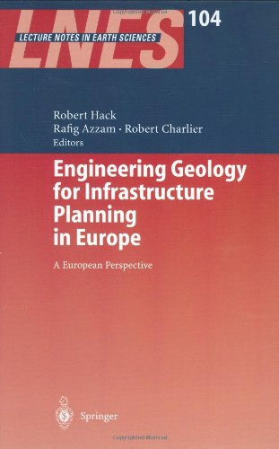
Author: Robert Hack, Rafig Azzam, Robert Charlier
Geologists and civil engineers related to infrastructure planning, design and building describe professional practices and engineering geological methods in different European infrastructure projects.
The Joint European Working Group of the ISSMGE, ISRM and IAEG for the Definition of Professional Tasks, Responsibilities and Co-operation in Ground Engineering
Some Basic Considerations about the Necessities and Possibilities of Cooperation between Civil Engineers and Engineering Geologists
Current Issues Relating to the Professional Practice of Engineering Geology in Europe
Feasibility Studies and Design of High-Speed Railway (TGV) Projects in Portugal
Austrian Guideline for Geomechanical Design of Tunnels
Soil Investigations Requirements from the Construction Industry
The Necessity of Combining Geologists and Engineers for Fieldwork in the Practice of Geotechnics
Contribution of On-Line Tools on Internet for the Teaching of Slopes and Tunnels Stability
German Higher Education in the Framework of the Bologna Process
International Standardisation of Ground Investigation and Testing Methods
Towards Quality Assurance and an Adequate Risk Management in Geotechnical Engineering
Aggregate Research in Support of European Standardisation
Standardised Methods for Sampling by Drilling and Excavation and for Groundwater Measurements
Interpretation of SCPT Data Using Cross-over and Cross-Correlation Methods
Evaluation Concept and Testing Method for Heavy Metal Contaminant Transport in the Underground
Geo-engineering Evaluation with Prime Consideration to Liquefaction Potential
Engineering Geology Property Parameters for the Tertiary in The Netherlands
Various Assessments of the Characteristic Values of Soil Cohesion and Friction Angle
Numerical Analysis of a Tunnel in an Anisotropy Rock Mass
Engineering-Geological Properties of Carbonate Rocks in Relation to Weathering Intensity
Engineering Geocryological Mapping for Construction in the Permafrost Regions
3D Terrestrial Laser Scanning as a New Field Measurement and Monitoring Technique
Engineering Geology in International Dredging and Infrastructure
Prediction of the Uniaxial Compressive Strength of a Greywacke
Self-healing of Fractures around Radioactive Waste Disposal in Clay Formations
Hydrogeological Investigations in Deep Wells
Java Tomography System (JaTS)
Using the Complete Nano Engineering Geological Spectrum to Assess the Performance of Clay Barriers
Rock Splitting in the Surrounds of Underground Openings
A Constitutive Model for Chemically Sensitive Clays
Relocation of a Problematic Segment of a Natural Gas Pipeline
Micro-structure and Swelling Behaviour of Compacted Clayey Soils
Physical and Numerical Modelling of a Two-Well Tracer Test
Soil Investigation Aspects of a Complex Metro Project in Amsterdam
Effects of the Determination of Characteristic Values of Soil Parameters
Basic Soil Properties of a Number of Artificial Clay - Sand Mixtures
The Effect of Sand on Strength of Mixtures of Bentonite-Sand
Nonconventional and Simple View of the Soil-Structure Interaction Problem
Effect of Pore Fluid Salinity on Compressibility and Shear Strength
Hydraulic Monitoring of Low-Permeability Argillite
Hydrogeologic Exploration during Excavation of the Lötschberg Base Tunnel
Coring Performance to Characterise the Geology in Bernissart
ConsoliTest - Using Surface Waves for Estimating Shear-Wave Velocities
Multi-level Groundwater Pressure Monitoring
Application of Borehole Radar for Monitoring Steam-Enhanced Remediation
Site Investigation for Abandoned Lignite Mines in Urban Environment
Behaviour of the Weak Rock Cut Slopes
Determination of the Failure Surface Geometry in Quick Slides
Obstacle Investigation RandstadRail in Rotterdam
Tunnelling in Urbanised Areas
Geotechnical Characterization and Stability of a Slope
Cross Connections at Pannerdensch Canal Tunnel
Effects of Lime Stabilization on Engineering Properties of Expansive Clay
The Belgian High-Speed Railway Soumagne Tunnel Project
High Speed Lines in Belgium
An Overview of the Geological and Geotechnical Aspects of the New Railway Line
Stability and Serviceability of a Gas Pipeline
Investigation of Karst Cavities and Earth Subsidence
Engineering Geological Considerations in Tunnelling through Thrust Zones
Tunnelling Problems in Older Sand Formations
Engineering Geological Model along the Zagreb-Split Highway
Overconsolidated, Early-Pleistocene Clays and HSLSouth
Location of Buried Mineshafts and Adits
Geological-Technical Aspects of Dimensional Stone Quarrying
Leibis/Lichte Dam in Germany
Creep Behaviour of Alpine Salt Rock
Assessment of Rock Slope Stability in Limestone Quarries
Studying Underground Motions in the Ramioul’s Cave
Drying-Up of a Natural Spring for Slope Stability
Suitability Maps of Underground Construction in South-Holland
Liquefied Natural Gas Terminal Siting in a Highly Seismic Region
National Environmental Monitoring of the Slovak Republic
Stability and Subsidence Assessment over Shallow Abandoned Mines
Numerical Modelling of Seismic Slope Stability
Evaluation of the “Bottegone” Subsidence
Influence of Underground Coal Mining on the Environment
Sustainable Remedial Measures of Creeping Bedrock Slopes
Problems in Defining the Criteria for an Earthquake Hazard Map
Aspects of Mine Abandonment and Implications on Infrastructure
Seismic and Flood Risk Evaluation in Spain
Landslide Risk Assessment in Italy
Modelling of Landslide-Triggering Factors
Management of Combined Natural Risks
Technique of Quantitative Assessment of Karst Risk
Cut-and-Cover Tunnel below Boulevard River Meuse
The Geotechnical Baseline Report as Risk Allocation Tool
Matching Monitoring, Risk Allocation and Baseline Reports
Smart Site Investigations Save Money
Back Matter
engineering geology and geotechnics for infrastructure
engineering geology and geotechnics
engineering geology training
engineering and geology
engineering geotechnical
Tags: Robert Hack, Rafig Azzam, Robert Charlier, Engineering, Geology, Geotechnics, Infrastructure, Development, Europe