
Most ebook files are in PDF format, so you can easily read them using various software such as Foxit Reader or directly on the Google Chrome browser.
Some ebook files are released by publishers in other formats such as .awz, .mobi, .epub, .fb2, etc. You may need to install specific software to read these formats on mobile/PC, such as Calibre.
Please read the tutorial at this link: https://ebookbell.com/faq
We offer FREE conversion to the popular formats you request; however, this may take some time. Therefore, right after payment, please email us, and we will try to provide the service as quickly as possible.
For some exceptional file formats or broken links (if any), please refrain from opening any disputes. Instead, email us first, and we will try to assist within a maximum of 6 hours.
EbookBell Team

4.3
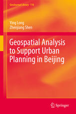
48 reviewsThis book describes a comprehensive framework of novel simulation approaches, conventional urban models, and related data mining techniques that will help develop planning support systems in Beijing as well as other mega-metropolitan areas. It investigates the relationships between human behaviors and spatial patterns in order to simulate activities in an urban space, visualize planning alternatives, and support decision making.
The book first explains urban space using geometric patterns, such as points, networks, and polygons, that help identify patterns of household and individual human behavior. Next, it details how novel simulation methodologies, such as cellular automaton and multi-agent systems, and conventional urban modeling, such as spatial interaction models, can be used to identify an optimal or a simulated solution for a better urban form.
The book develops a comprehensive land use and transportation integrated model used to explore the spatial patterns of mutual interaction between human mobility and urban space. This model can help forecast the distribution of different types of households, rent prices, and land prices, as well as the distribution of routes and traffic volume based on an appraisal of labor demand and supply.
This book shows how geospatial analysis can be a useful tool for planners and decision makers to help in ascertaining patterns of activities and support urban planning. Offering both novel and conventional approaches to urban modeling, it will appeal to researchers, students, and policy makers looking for the optimal way to plan the d
evelopment of a mega-metropolitan area.