
Most ebook files are in PDF format, so you can easily read them using various software such as Foxit Reader or directly on the Google Chrome browser.
Some ebook files are released by publishers in other formats such as .awz, .mobi, .epub, .fb2, etc. You may need to install specific software to read these formats on mobile/PC, such as Calibre.
Please read the tutorial at this link: https://ebookbell.com/faq
We offer FREE conversion to the popular formats you request; however, this may take some time. Therefore, right after payment, please email us, and we will try to provide the service as quickly as possible.
For some exceptional file formats or broken links (if any), please refrain from opening any disputes. Instead, email us first, and we will try to assist within a maximum of 6 hours.
EbookBell Team

5.0
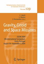
80 reviewsThe lAG International Symposium on Gravity, Geoid, and Space Missions 2004 (GGSM2004) was lield in the beautiful city of Porto, Portugal, from 30 August to 3 September 2004. This symposium encompassed the themes of Commission 2 (Gravity Field) of the newly structured lAG, as well as interdisciplinary topics related to geoid and gravity modeling, with special attention given to the current and planned gravi- dedicated satellite missions. The symposium also followed in the tradition of mid-term meetings that were held between the quadrennial joint meetings of the International Geoid and Gravity Commissions. The previous mid-term meetings were the International Symposia on Gravity, Geoid, and Marine Geodesy (Tokyo, 1996), and Gravity, Geoid, and Geodynamics (Banff, 2000). GGSM2004 aimed to bring together scientists from different areas in the geosciences, working with gravity and geoid related problems, both from the theoretical and practical points of view. Topics of interest included the integration of heterogeneous data and contributions from satellite and airborne techniques to the study of the spatial and temporal variations of the gravity field. In addition to the special focus on the CHAMP, GRACE, and GOCE satellite missions, attention was also directed toward projects addressing topographic and ice field mapping using SAR, LIDAR, and laser altimetry, as well as missions and studies related to planetary geodesy.