
Most ebook files are in PDF format, so you can easily read them using various software such as Foxit Reader or directly on the Google Chrome browser.
Some ebook files are released by publishers in other formats such as .awz, .mobi, .epub, .fb2, etc. You may need to install specific software to read these formats on mobile/PC, such as Calibre.
Please read the tutorial at this link: https://ebookbell.com/faq
We offer FREE conversion to the popular formats you request; however, this may take some time. Therefore, right after payment, please email us, and we will try to provide the service as quickly as possible.
For some exceptional file formats or broken links (if any), please refrain from opening any disputes. Instead, email us first, and we will try to assist within a maximum of 6 hours.
EbookBell Team

0.0
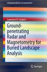
0 reviewsThis book presents the integrated use of magnetometry and ground-penetrating radar geophysical mapping to understand the human presence within buried archaeological landscapes. Ground-penetrating radar can be used to identify buried living surfaces, geological stratigraphy and the architectural remains of sites in three-dimensions. Magnetometry can produce images denoting differences on the composition of those materials, both anthropogenic and natural, but with more limited three-dimensional resolution. The integration of the two has a unique ability to resolve and interpret these buried materials, differentiated between the human-caused and natural layers, and place all buried features within historic landscapes. The final product of geophysical integration, along with some limited subsurface testing, produces a holistic analysis of human adaptations to, and modifications of, the ancient landscape. Examples are shown from sites in Roman Croatia and Britain, Medieval Ireland, Colonial Connecticut, and an Archaic site in the Colorado Rocky Mountains. These examples from very different environments, time periods and cultural groups illustrate how the integrated geophysical methodology can interpret, on a scale approaching many hectares, the ancient landscapes within which people lived.