logo

EbookBell.com

Most ebook files are in PDF format, so you can easily read them using various software such as Foxit Reader or directly on the Google Chrome browser.
Some ebook files are released by publishers in other formats such as .awz, .mobi, .epub, .fb2, etc. You may need to install specific software to read these formats on mobile/PC, such as Calibre.

Please read the tutorial at this link:  https://ebookbell.com/faq 


We offer FREE conversion to the popular formats you request; however, this may take some time. Therefore, right after payment, please email us, and we will try to provide the service as quickly as possible.


For some exceptional file formats or broken links (if any), please refrain from opening any disputes. Instead, email us first, and we will try to assist within a maximum of 6 hours.

EbookBell Team
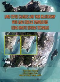
Land Cover Changes And Their Relationship With Land Surface Temperature Using Remote Sensing Technique Kok Chooi Tan Hwee San Lim Mat Jafri Mohd Zubir

  • SKU: BELL-51629712
Land Cover Changes And Their Relationship With Land Surface Temperature Using Remote Sensing Technique Kok Chooi Tan Hwee San Lim Mat Jafri Mohd Zubir
$ 31.00 $ 45.00 (-31%)

4.8

64 reviews

Land Cover Changes And Their Relationship With Land Surface Temperature Using Remote Sensing Technique Kok Chooi Tan Hwee San Lim Mat Jafri Mohd Zubir instant download after payment.

Publisher: Penerbit USM
File Extension: EPUB
File size: 1.9 MB
Pages: 66
Author: Kok Chooi Tan; Hwee San Lim; Mat Jafri Mohd Zubir
ISBN: 9789838617109, 9838617105
Language: English
Year: 2013

Product desciption

Land Cover Changes And Their Relationship With Land Surface Temperature Using Remote Sensing Technique Kok Chooi Tan Hwee San Lim Mat Jafri Mohd Zubir by Kok Chooi Tan; Hwee San Lim; Mat Jafri Mohd Zubir 9789838617109, 9838617105 instant download after payment.

Nowadays, land cover changes are a major issue of global environmental change. Investigation on this subject has now been done by using remote sensing application. Research has been done in the Penang Island, which is one of the affected areas due to industrial and residential areas growth. Thus, this monograph is published to demonstrate an effective application through remote sensing technique to explore the environmental change and its impact on local environment that is caused by abrupt change in land use. It provides appropriate and comprehensive information for researchers involved in the study of environmental management, urban planning, land surface characteristics, and related support fields. This monograph highlights the relationship between land surface temperature and normalized difference vegetation index as the major results. The remote sensing technique used in this study was found to be efficient. It reduced the time for the analysis of land cover changes and was found to be a useful tool.

Related Products