logo

EbookBell.com

Most ebook files are in PDF format, so you can easily read them using various software such as Foxit Reader or directly on the Google Chrome browser.
Some ebook files are released by publishers in other formats such as .awz, .mobi, .epub, .fb2, etc. You may need to install specific software to read these formats on mobile/PC, such as Calibre.

Please read the tutorial at this link:  https://ebookbell.com/faq 


We offer FREE conversion to the popular formats you request; however, this may take some time. Therefore, right after payment, please email us, and we will try to provide the service as quickly as possible.


For some exceptional file formats or broken links (if any), please refrain from opening any disputes. Instead, email us first, and we will try to assist within a maximum of 6 hours.

EbookBell Team
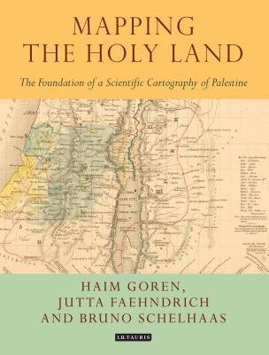
Mapping The Holy Land The Foundation Of A Scientific Cartography Of Palestine Haim Goren Bruno Schelhaas

  • SKU: BELL-7284948
Mapping The Holy Land The Foundation Of A Scientific Cartography Of Palestine Haim Goren Bruno Schelhaas
$ 31.00 $ 45.00 (-31%)

4.1

80 reviews

Mapping The Holy Land The Foundation Of A Scientific Cartography Of Palestine Haim Goren Bruno Schelhaas instant download after payment.

Publisher: I. B. Tauris & Company
File Extension: PDF
File size: 32 MB
Pages: 256
Author: Haim Goren; Bruno Schelhaas
ISBN: 9781784534547, 1784534544
Language: English
Year: 2017

Product desciption

Mapping The Holy Land The Foundation Of A Scientific Cartography Of Palestine Haim Goren Bruno Schelhaas by Haim Goren; Bruno Schelhaas 9781784534547, 1784534544 instant download after payment.

Mapping the Holy Land provides a unique study of the cartography of the Holy Land during the formative period of its development. Through a detailed study of the work of three of the leading figures of the era-Augustus Petermann, Physical Geographer Royal to Queen Victoria; cartographer Charles Meredith van de Velde, who produced the finest map of the region at the time; and Edward Robinson, founder of modern Palestinology-the authors explore the complex cultural, cartographic and technical processes that shaped and determined the resulting maps of the region. Making full use of newly discovered archival material, and richly illustrated in both colour and black and white, Mapping the Holy Land is essential reading for cartographers, historical geographers, historians of mapmaking, and for all those with an interest in the Holy Land and the history of Palestine.

Related Products