logo

EbookBell.com

Most ebook files are in PDF format, so you can easily read them using various software such as Foxit Reader or directly on the Google Chrome browser.
Some ebook files are released by publishers in other formats such as .awz, .mobi, .epub, .fb2, etc. You may need to install specific software to read these formats on mobile/PC, such as Calibre.

Please read the tutorial at this link:  https://ebookbell.com/faq 


We offer FREE conversion to the popular formats you request; however, this may take some time. Therefore, right after payment, please email us, and we will try to provide the service as quickly as possible.


For some exceptional file formats or broken links (if any), please refrain from opening any disputes. Instead, email us first, and we will try to assist within a maximum of 6 hours.

EbookBell Team
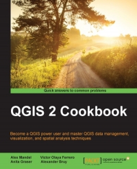
Qgis 2 Cookbook Become A Qgis Power User And Master Qgis Data Management Visualization And Spatial Analysis Techniques Alex Mandel

  • SKU: BELL-5470194
Qgis 2 Cookbook Become A Qgis Power User And Master Qgis Data Management Visualization And Spatial Analysis Techniques Alex Mandel
$ 31.00 $ 45.00 (-31%)

4.7

106 reviews

Qgis 2 Cookbook Become A Qgis Power User And Master Qgis Data Management Visualization And Spatial Analysis Techniques Alex Mandel instant download after payment.

Publisher: Packt Publishing
File Extension: PDF
File size: 16.25 MB
Pages: 390
Author: Alex Mandel, Victor Olaya Ferrero, Anita Graser, Alexander Bruy
ISBN: 9781783984961, 1783984961
Language: English
Year: 2016

Product desciption

Qgis 2 Cookbook Become A Qgis Power User And Master Qgis Data Management Visualization And Spatial Analysis Techniques Alex Mandel by Alex Mandel, Victor Olaya Ferrero, Anita Graser, Alexander Bruy 9781783984961, 1783984961 instant download after payment.

QGIS is a user-friendly, cross-platform desktop geographic information system used to make maps and analyze spatial data. QGIS allows users to understand, question, interpret, and visualize spatial data in many ways that reveal relationships, patterns, and trends in the form of maps. This book is a collection of simple to advanced techniques that are needed in everyday geospatial work, and shows how to accomplish them with QGIS. You will begin by understanding the different types of data management techniques, as well as how data exploration works. You will then learn how to perform classic vector and raster analysis with QGIS, apart from creating time-based visualizations. Finally, you will learn how to create interactive and visually appealing maps with custom cartography. By the end of this book, you will have all the necessary knowledge to handle spatial data management, exploration, and visualization tasks in QGIS.

Related Products

Qgis Blueprints Ben Mearns

4.7

106 reviews
$45.00 $31.00