Most ebook files are in PDF format, so you can easily read them using various software such as Foxit Reader or directly on the Google Chrome browser.
Some ebook files are released by publishers in other formats such as .awz, .mobi, .epub, .fb2, etc. You may need to install specific software to read these formats on mobile/PC, such as Calibre.
Please read the tutorial at this link: https://ebookbell.com/faq
We offer FREE conversion to the popular formats you request; however, this may take some time. Therefore, right after payment, please email us, and we will try to provide the service as quickly as possible.
For some exceptional file formats or broken links (if any), please refrain from opening any disputes. Instead, email us first, and we will try to assist within a maximum of 6 hours.
EbookBell Team
5.0
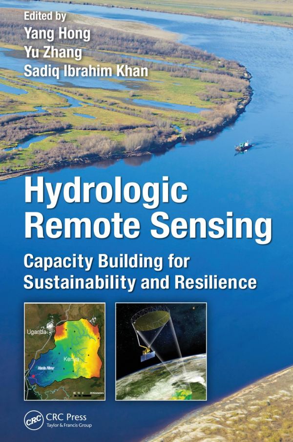
108 reviewsDriven by the societal needs and improvement in sensor technology and image processing techniques, remote sensing has become an essential geospatial tool for understanding the Earth and managing Human-Earth interactions. Remote Sensing for Sustainability introduces the current state of the art remote sensing knowledge integral for monitoring the world’s natural resources and environments, managing exposure to natural disasters and man-made risks, and helping understand the sustainability and productivity of natural ecosystems.
Bridging the gap between remote sensing and sustainability science this book examines theories and methods as well as practical applications of sustainable development for cities using remote sensing; focuses on remote sensing methods and techniques for sustainable natural resources with emphasize on forests; answers questions on how and what the remote sensing methods and techniques can do for the sustainability of environmental systems; and examines the issues of energy use and sustainable energy sources using remote sensing technology in countries such as Germany, China, the U.S, drawing on case studies to demonstrate the applicability of remote sensing techniques.
This comprehensive guide, which can serve to professors, researchers, and students alike, takes in consideration the United Nations set of sustainable development goals and intends to contribute to the GEO’s Strategic Plan by addressing and exemplifying a number of societal benefit areas of remote sensing data sets, methods, and techniques for sustainable development.