Most ebook files are in PDF format, so you can easily read them using various software such as Foxit Reader or directly on the Google Chrome browser.
Some ebook files are released by publishers in other formats such as .awz, .mobi, .epub, .fb2, etc. You may need to install specific software to read these formats on mobile/PC, such as Calibre.
Please read the tutorial at this link: https://ebookbell.com/faq
We offer FREE conversion to the popular formats you request; however, this may take some time. Therefore, right after payment, please email us, and we will try to provide the service as quickly as possible.
For some exceptional file formats or broken links (if any), please refrain from opening any disputes. Instead, email us first, and we will try to assist within a maximum of 6 hours.
EbookBell Team
5.0
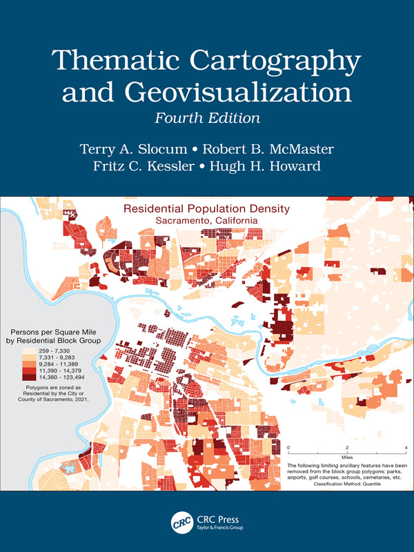
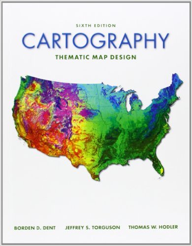
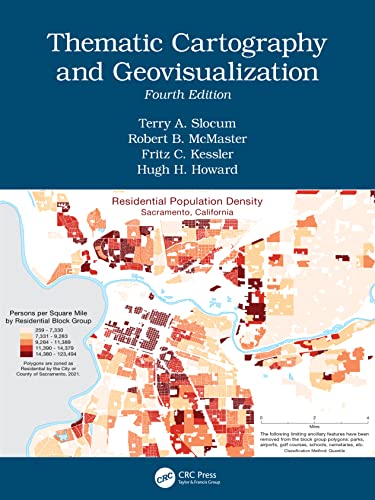
58 reviewsThis comprehensive and well-established cartography textbook covers the theory and the practical applications of map design and the appropriate use of map elements. It explains the basic methods for visualizing and analyzing spatial data and introduces the latest cutting-edge data visualization techniques. The fourth edition responds to the extensive developments in cartography and GIS in the last decade, including the continued evolution of the Internet and Web 2.0; the need to analyze and visualize large data sets (commonly referred to as Big Data); the changes in computer hardware (e.g., the evolution of hardware for virtual environments and augmented reality); and novel applications of technology.
Key Features of the Fourth Edition:
There is ample material for either a one or two-semester course in thematic cartography and geovisualization. This textbook provides undergraduate and graduate students in geoscience, geography, and environmental sciences with the most valuable up-to-date learning resource available in the cartographic field. It is a great resource for professionals and experts using GIS and Cartography and for organizations and policy makers involved in mapping projects.