logo

EbookBell.com

Most ebook files are in PDF format, so you can easily read them using various software such as Foxit Reader or directly on the Google Chrome browser.
Some ebook files are released by publishers in other formats such as .awz, .mobi, .epub, .fb2, etc. You may need to install specific software to read these formats on mobile/PC, such as Calibre.

Please read the tutorial at this link:  https://ebookbell.com/faq 


We offer FREE conversion to the popular formats you request; however, this may take some time. Therefore, right after payment, please email us, and we will try to provide the service as quickly as possible.


For some exceptional file formats or broken links (if any), please refrain from opening any disputes. Instead, email us first, and we will try to assist within a maximum of 6 hours.

EbookBell Team
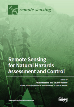
Remote Sensing For Natural Hazards Assessment And Control Paolo Mazzanti

  • SKU: BELL-50656076
Remote Sensing For Natural Hazards Assessment And Control Paolo Mazzanti
$ 31.00 $ 45.00 (-31%)

5.0

48 reviews

Remote Sensing For Natural Hazards Assessment And Control Paolo Mazzanti instant download after payment.

Publisher: MDPI
File Extension: PDF
File size: 128.1 MB
Pages: 406
Author: Paolo Mazzanti, Saverio Romeo
Language: English
Year: 2023

Product desciption

Remote Sensing For Natural Hazards Assessment And Control Paolo Mazzanti by Paolo Mazzanti, Saverio Romeo instant download after payment.

Each year, natural hazards, such as earthquakes, landslides, avalanches, tsunamis, floods, wildfires, severe storms, and drought, , affect humans worldwide, resulting in deaths, suffering, and economic losses. According to insurance broker Aon, 2010–2019 was the worst decade on record for economic losses due to disasters triggered by natural hazards, amounting to USD 3 trillion, which is USD 1 trillion more than for the period of 2000–2009. In 2019, the economic losses from disasters caused by natural hazards were estimated at over USD 200 billion (UNDRR Annual Report, 2019). In this context, remote sensing shows high potential to provide valuable information, at various spatial and temporal scales, concerning natural processes and their associated risks. The recent advances in remote sensing technologies and analysis, in terms of sensors, platforms, and techniques, are strongly contributing to the development of natural hazards research. With this Special Issue titled “Remote Sensing for Natural Hazards Assessment and Control”, we proposed state-of-the-art research that specifically addresses multiple aspects on the use of remote sensing (RS) for Natural Hazards (NH). The aim was therefore to collect innovative methodologies, expertise, and capabilities to detect, assess, monitor, and model natural hazards. The present Special Issue of Remote Sensing encompasses 18 open access papers presenting scientific studies based on the exploitation of a broad range of RS data and techniques, as well as focusing on a well-assorted sample of NH types.

Related Products