
Most ebook files are in PDF format, so you can easily read them using various software such as Foxit Reader or directly on the Google Chrome browser.
Some ebook files are released by publishers in other formats such as .awz, .mobi, .epub, .fb2, etc. You may need to install specific software to read these formats on mobile/PC, such as Calibre.
Please read the tutorial at this link: https://ebookbell.com/faq
We offer FREE conversion to the popular formats you request; however, this may take some time. Therefore, right after payment, please email us, and we will try to provide the service as quickly as possible.
For some exceptional file formats or broken links (if any), please refrain from opening any disputes. Instead, email us first, and we will try to assist within a maximum of 6 hours.
EbookBell Team

4.7
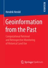
36 reviewsHendrik Herold explores potentials and hindrances of using retrospective geoinformation for monitoring, communicating, modeling, and eventually understanding the complex and gradually evolving processes of land cover and land use change. Based on a comprehensive review of literature, available data sets, and suggested algorithms, the author proposes approaches for the two major challenges: To address the diversity of geographical entity representations over space and time, image segmentation is considered a global non-linear optimization problem, which is solved by applying a metaheuristic algorithm. To address the uncertainty inherent to both the data source itself as well as its utilization for change detection, a probabilistic model is developed. Experimental results demonstrate the capabilities of the methodology, e.g., for geospatial data science and earth system modeling.